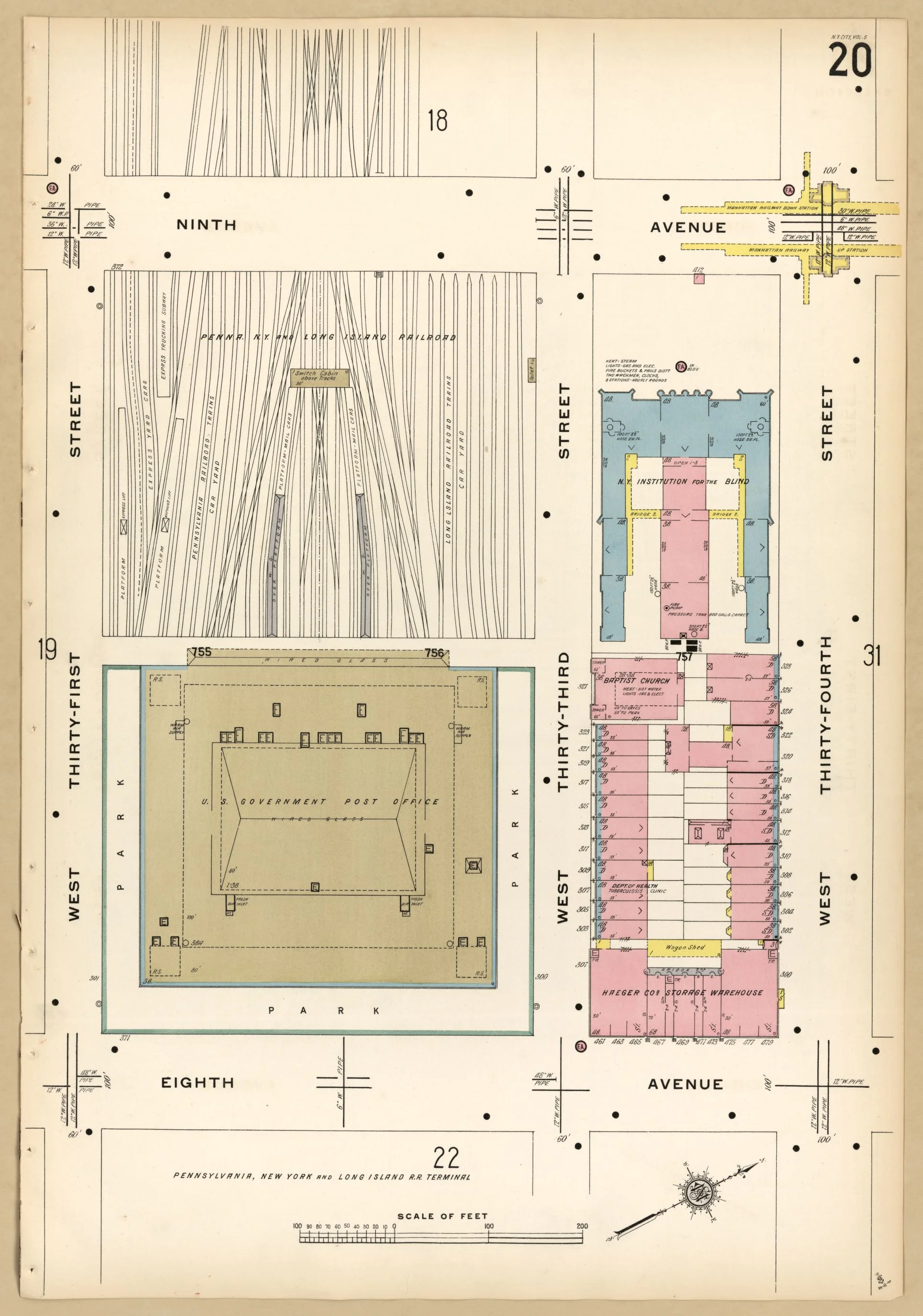
Long Island Railroad Map (1885)

Long Island Railroad Map (1885)
from $13.99
Map of New York City, Brooklyn, and vicinity, shewing [sic] suburban lines of Long Island Railroad and its connections. Manhattan elevated lines are seen in black with Long Island Railroad lines in red.
Size:
Quantity: