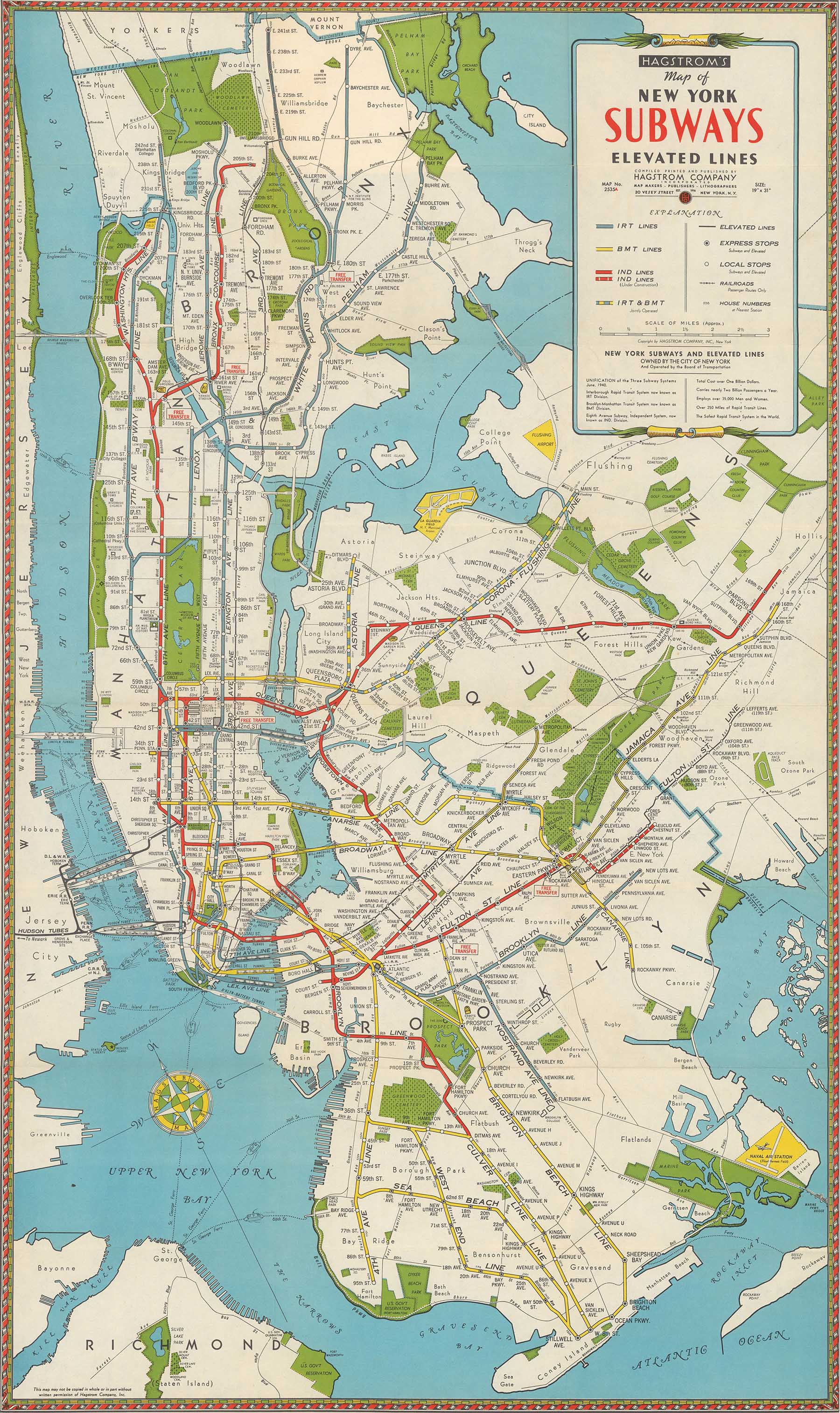
1942 Subway Map

1942 Subway Map

from $17.99

1942 Hagstrom Subway Map. The map shows subway, elevated, and surface lines along with major roads, landmarks, streets, and tunnels. IRT, BMT and IND lines are all illustrated.

Size:
Quantity:
Add To Cart
FLY TWA (Times Square)

FLY TWA (Times Square)

from $19.99
NY Arterial System, 1964.jpg
sale

Robert Moses' Proposed Expressway Map (13x19")

Sale Price:$28.99 Original Price:$29.99
Custom Historic NYC Land Maps loman.jpg
sale

Custom Historic NYC Land Maps

Sale Price:$39.99 Original Price:$49.99
Lower Manhattan Expressway Map (1967)

Lower Manhattan Expressway Map (1967)

from $15.99
1911 Fire Insurance Map showing Penn Station

1911 Fire Insurance Map showing Penn Station

from $12.99