Custom Historic NYC Land Maps


Custom Historic NYC Land Maps
Historic fire insurance maps dating from the 1880s - 1915 are available for all Five Boroughs. Please fill out the form with the address of the area and we will send you the corresponding historic map. Message us with questions or if you need help.
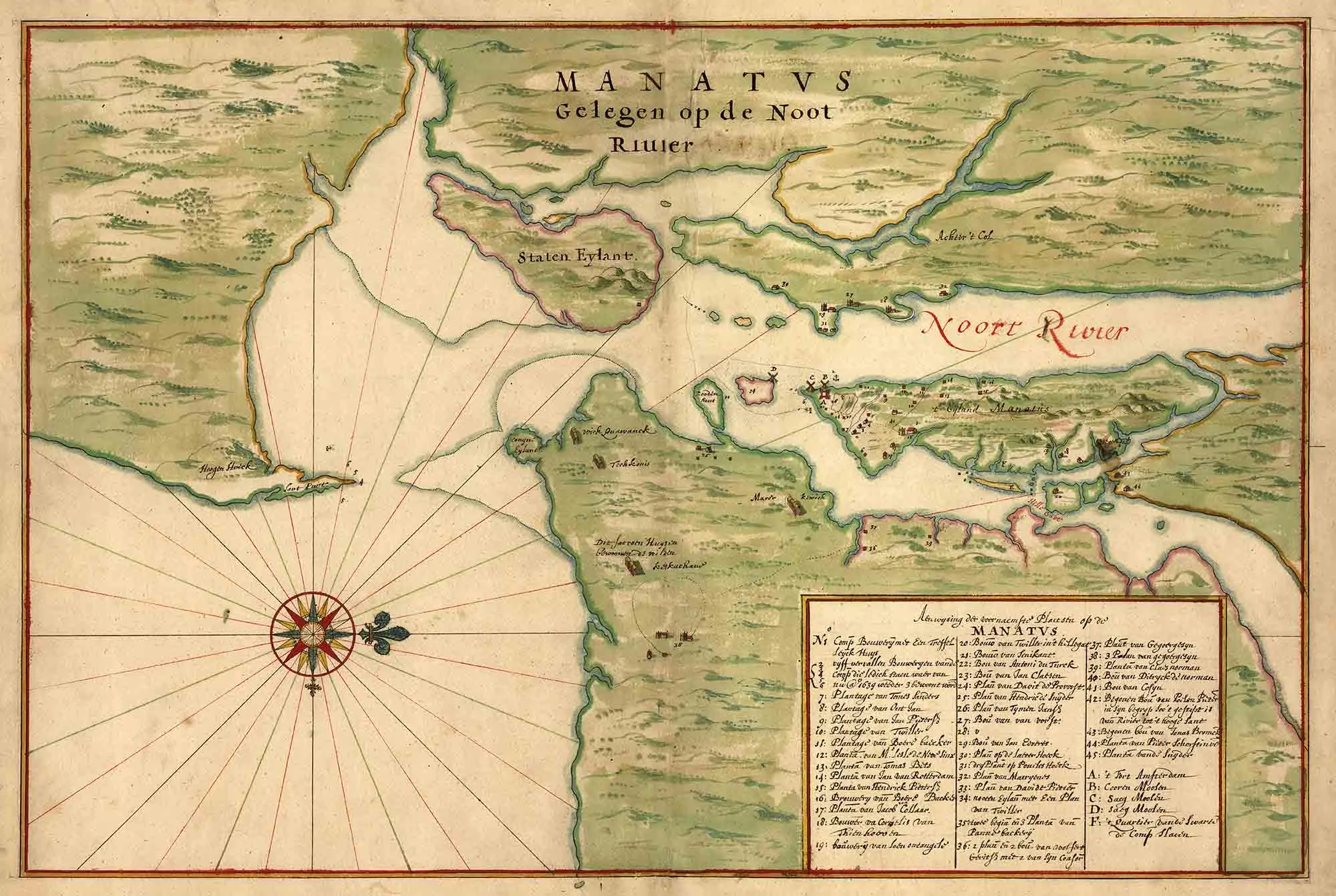
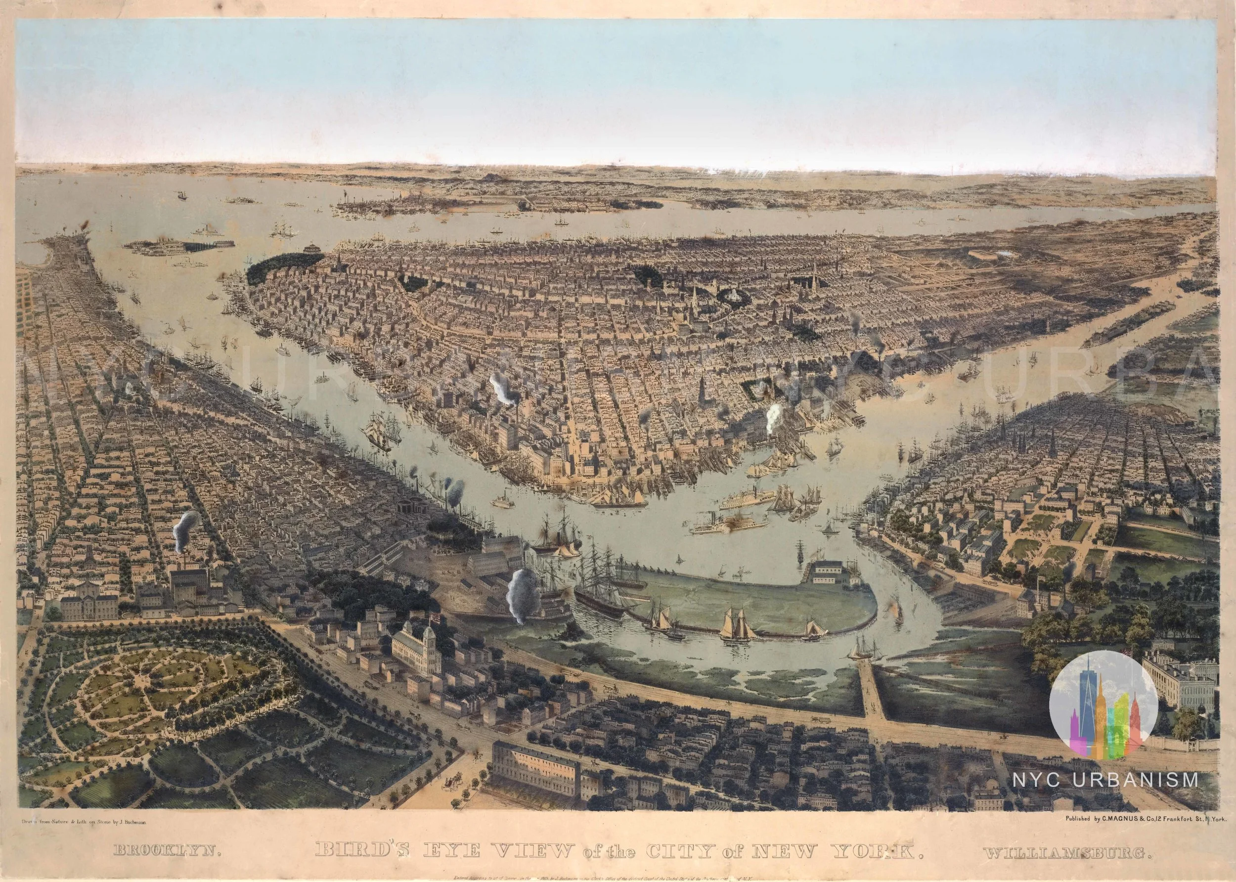
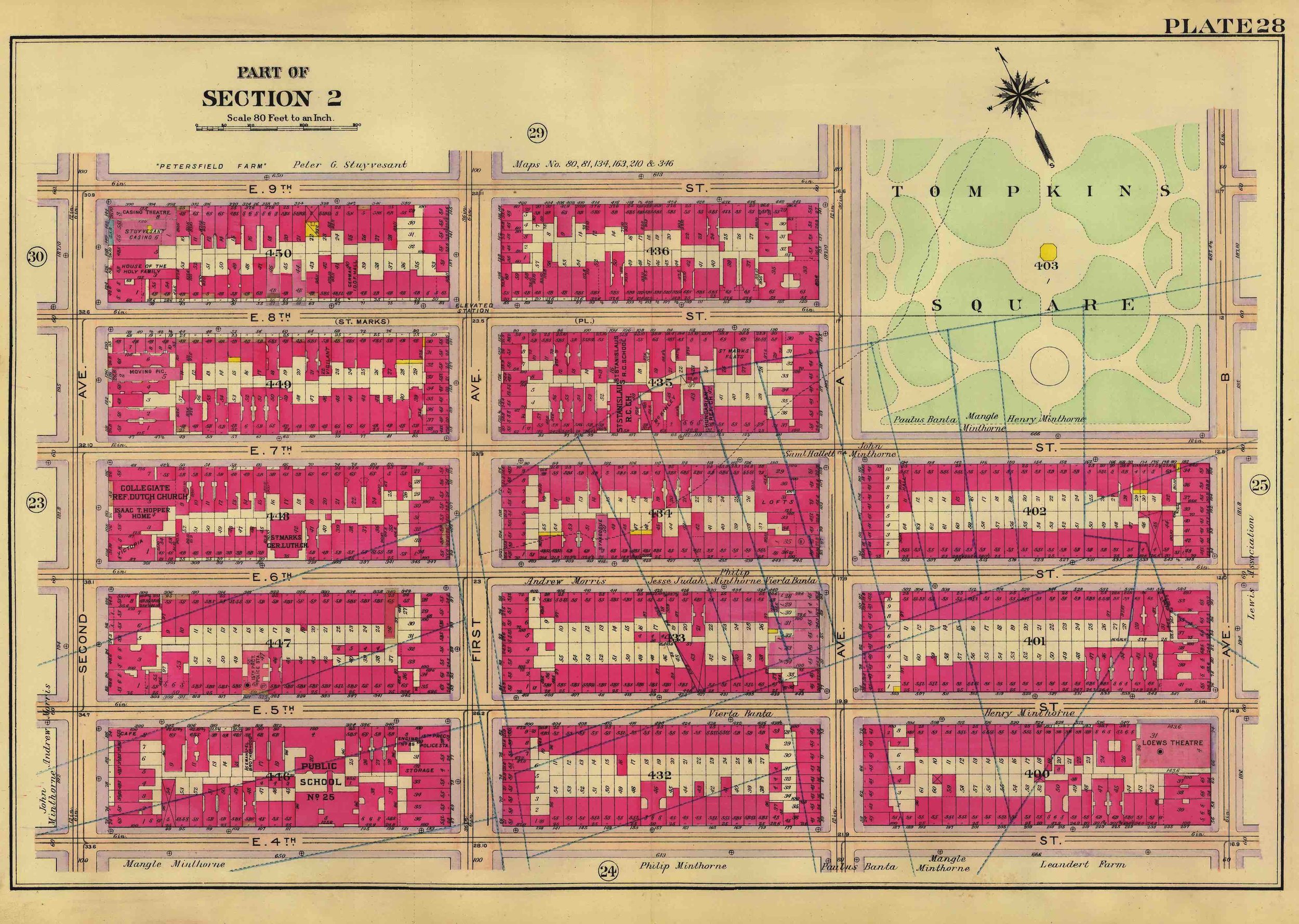
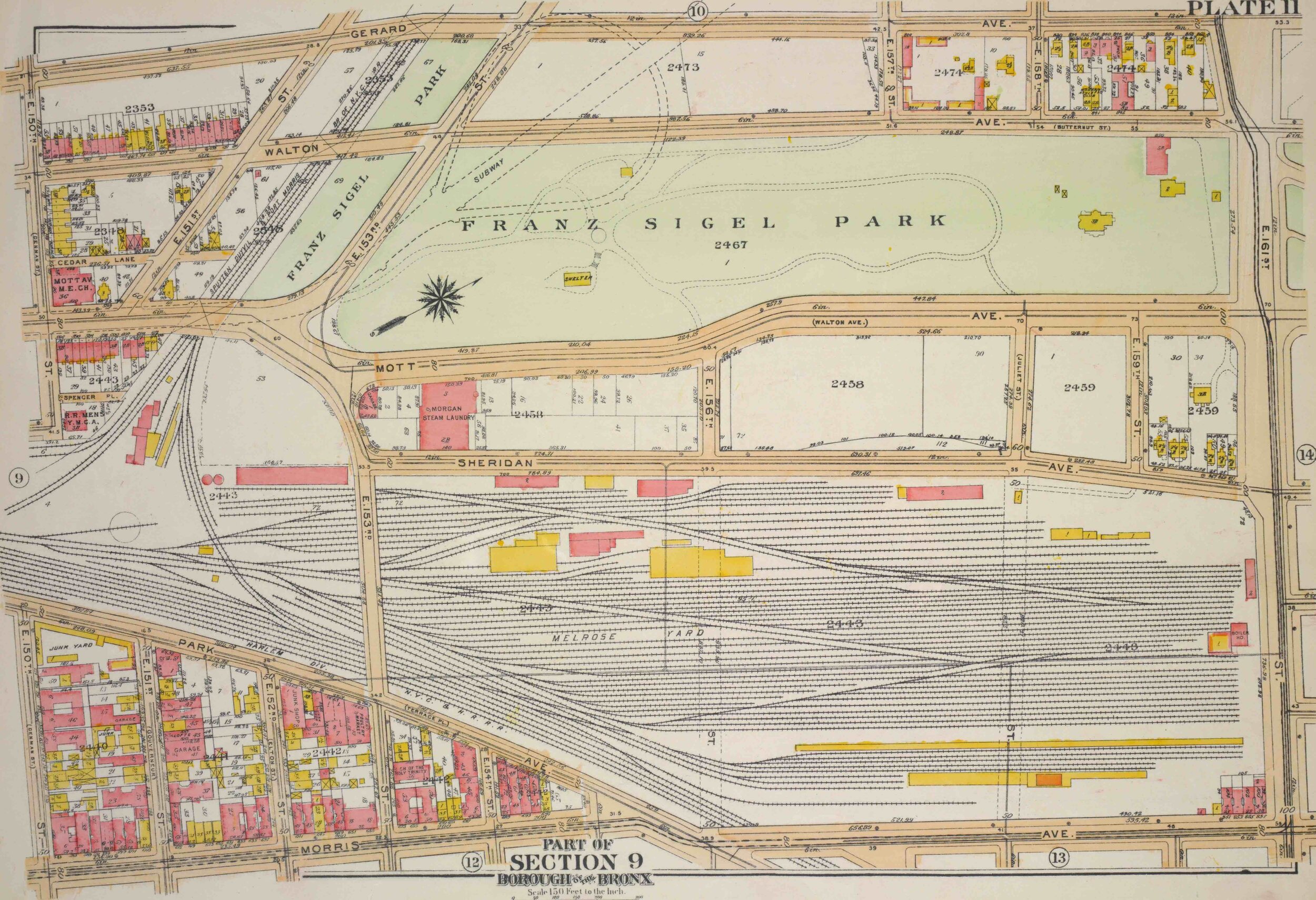
These maps were used by insurance companies to assess properties and have become extremely useful to urban historians, as they identify not just the pattern of streets and blocks but the precise lot or building dimensions, outline, and lot coverage; height in stories; street and sidewalk widths; addresses; lot owner; stream; farm lines; and the City's block and lot numbers. The color of the lot determines the type of exterior, most often pink for brick.
The original maps were part of a “Land Book” that was broken up into several volumes. Each page, or plate depicts a section of the map, usually four or five square blocks. An index page in the front of the book helps the user find a specific plate, or view the legend.
Printed on museum quality archival paper, 13x19”