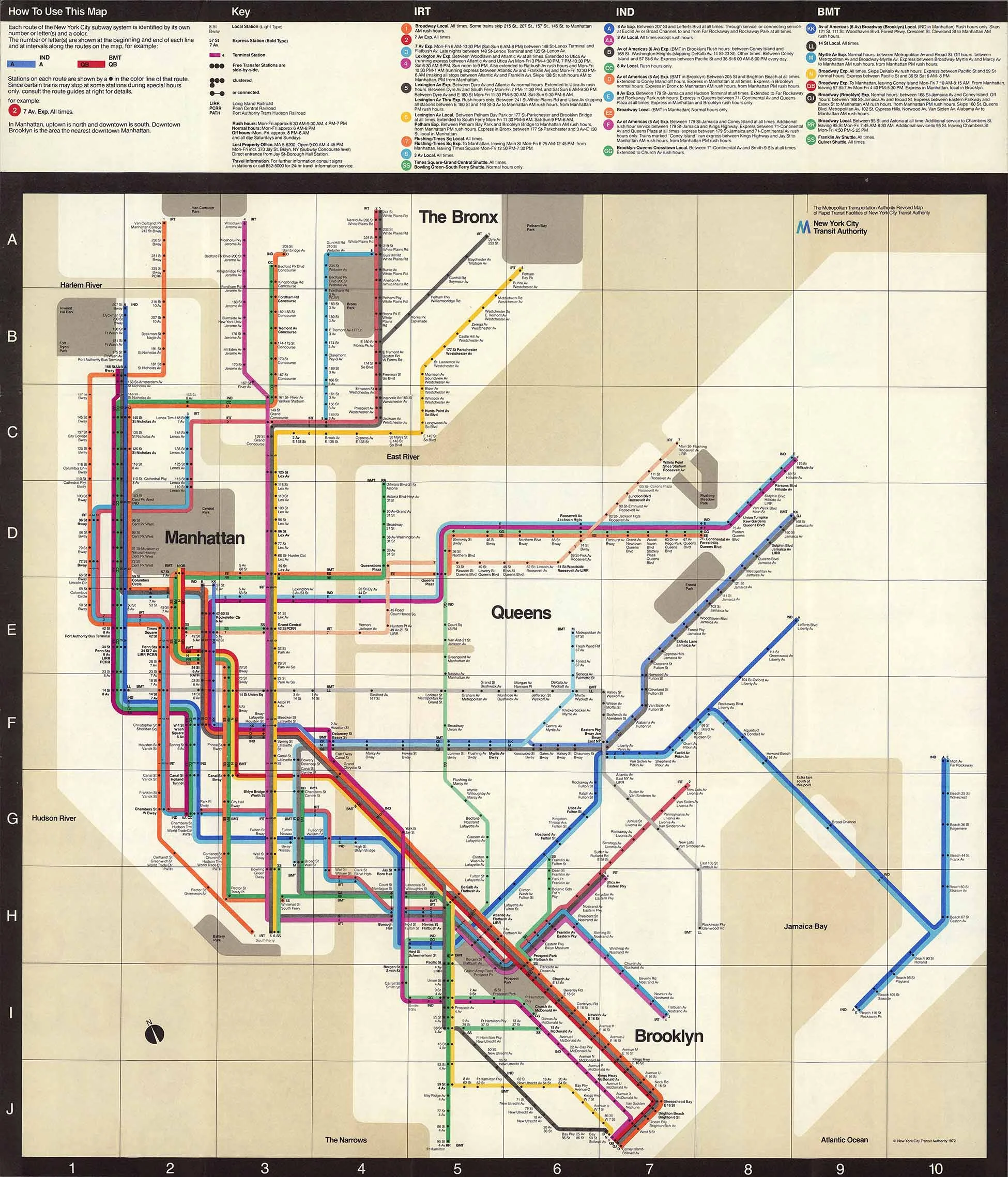
1924 Routes of the Interborough Rapid Transit Company

1924 Routes of the Interborough Rapid Transit Company
from $12.99
IRT subway map from 1924 showing all subway and elevated lines in Manhattan, Brooklyn, Queens and the Bronx.
Size:
Quantity: