
#MapMondays HOLC Redlining Maps
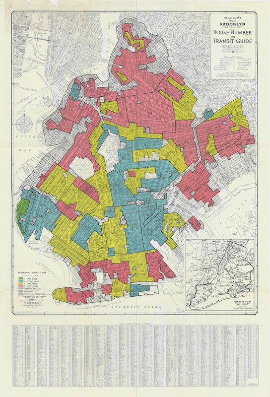
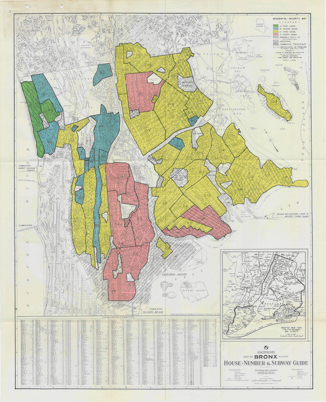
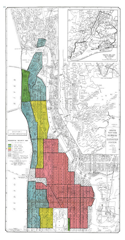
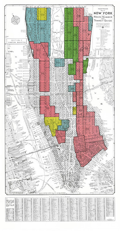
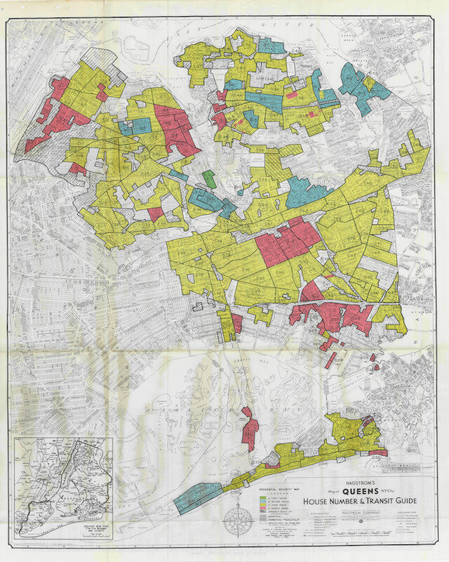
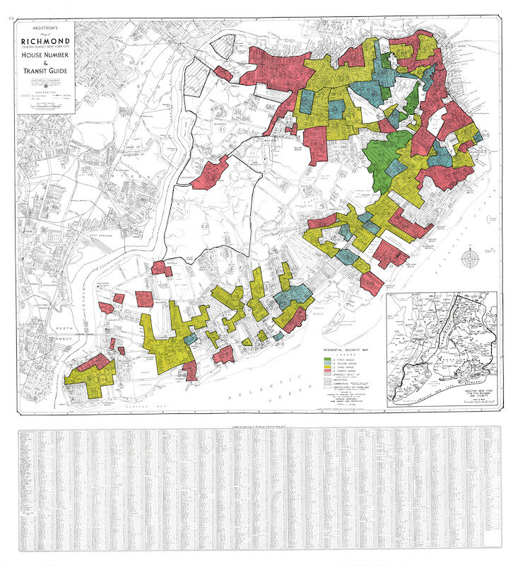
1938 Home Owners Loan Corporation (HOLC) redlining maps of New York City
Part of an Underwriting Manual, these maps determined mortgage lending requirements, sectioning off areas of the inner city that were not considered safe investments. Redlined neighborhoods were often based on race, further segregating urban areas and pushing the middle class out. During this period, If you were black, getting a mortgage in New York City was next to impossible and neighborhoods decayed as many owners in these (red) areas were unable to invest in their properties. In Brooklyn, most of North Brooklyn was redlined, as well as Cobble Hill, Gowanus, Sunset Park, Dumbo, Fort Greene, Bed Stuy, East New York, and Coney Island.
Green = best investment (first grade) , red = worst investment (fourth grade).
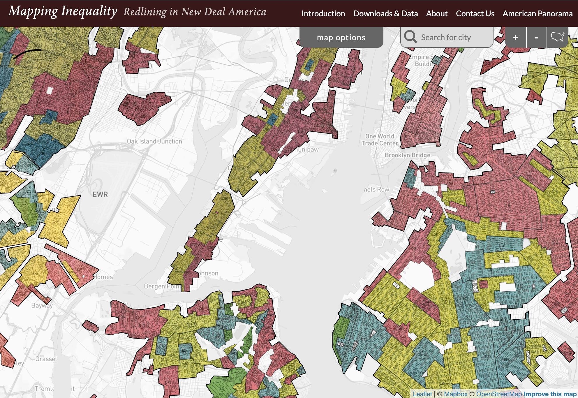
University of Richmond's Mapping Inequality provides an interactive redlining map of America.